Tree disease: a sneaky forest threat
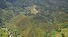
Native tree diseases are a particularly common menace to Oregon’s western forests. Among the most prevalent diseases in Oregon are Swiss needle cast and laminated root rot. Swiss needle cast is a foliage disease that affects Douglas-fir trees. It causes trees to prematurely shed their needles.Laminated root rot attacks and kills a tree’s root system. This hinders its ability to suck up water and soil nutrients. Trees affected by root disease are also more susceptible to bark beetles and wood borers, and are more likely to fall during a storm or high winds.
Disease threats to Oregon forestsDwarf MistletoesParasitic, flowering plants that can slow tree growth, deform crowns and branches, and eventually kill the trees in which they grow.Foliage DiseasesCaused by fungi that infect tree leaves or needles and cause them to fall prematurely from the tree. In the case of foliage diseases known as needle blights, the dead or partially dead needles often remain attached to the tree’s branches.Root Diseases